Explore our hiking trails

Current disturbances
Current diversions, conditions & closures on the trails
UP in the HARZ can be found here here.
Our circular hiking trails at a glance

Family-friendly mountain meadow nature trail
The mountain meadow nature trail around Benneckenstein is a family and stroller-friendly themed and circular hiking trail. The diversity of the mountain meadows in harmony with people and nature is described on various display boards / stations and an accompanying booklet. Children can get to know the typical Harz mountain plants and animals as well as the healing powers of some meadow herbs.
Route: 5.0 km I Duration: 1:20 h I Difficulty: medium
Harz location: Benneckenstein
Starting point: forest aisle

Circular hiking trail Zillierbach Dam
A varied hike around the Zillierbach Dam via the Peterstein observation point with stamping point and rest area, to the Hermannschacht, to the Hirschbrunnen rest area and back to the Harz town of Elbingerode.
Distance: 10.0 km I Duration: 2:40 h I Difficulty: medium
Harz location: Elbingerode
Starting point: corner of Waldbreite / Unter den Birken

Family-friendly circular route around the Königshütte dam (HWN 41 & 42)
The hike around the Trogfurther Bridge in Königshütte is an easy tour with great views for the whole family. You walk right by the water around the transfer barrier.
Distance: 7.2 km I Duration: 2:05 h I Difficulty: easy
Harz location: Königshütte
Starting point: hiking car park
(Southern exit of the village of Königshütte - road 98 towards Tanne)

Circular hiking trail Rotestein - suspension bridge - Harzköhlerei (kurz) (HWN 54,60 & 9915)
A scenic and worthwhile circular hike to the viewpoints on the Rappbode Dam and on the Rotestein near Hasselfelde, the suspension bridge and the events of Harzdrenalin as well as the Harzköhlerei Stemberghaus.
length: 9,6 km I duration: 2:35 h I level: medium

Circular hiking trail from Neuwerk to the Rappbode Dam with Titan RT (HWN 62 & 9915)
An approx. 13 km long and short circular hiking trail from Neuwerk with many highlights and varied sections of the trail.
Distance: 12.8 km I Duration: 3:55 h I Difficulty: medium
Harz location: Neuwerk
Starting point: car park or Neuwerk bus stop

Circular route to the open-air and small border museum Sorge (HWN 46)
With this hike you go on a historical journey near the Harz town of Sorge. Back to where Germany was once divided by an inner-German border with the then GDR and FRG.
Route: 6.9 km I Duration: 1:50 h I Difficulty: easy
Harzort: Sorge
Starting point: car park at the border museum Sorge

Circular hiking trail Stiege stave church
Small circular route through the village of Stiege along the Lake Stiege directly to the stave church Stiege. Entertaining, eventful and relaxed - the approx. 3.2 km short circular hiking trail takes you through the tranquil Harz town of Stiege.
Distance: 3.2 km I Duration: 0:50 h I Difficulty: easy
Harz location: Stiege
Starting point: car park at Stiege train station

Tanner-Höhenvieh-Path with detour to Kapitelsberg (HWN 44)
On the circular route around Tanne you will get different insights into the place, the surrounding area and the Red Harzer Höhenvieh - which gives the circular route its name.
Route: 9.6 km I Duration: 2:45 h I Difficulty: medium
Resin location: fir
Starting point: Hiking meeting point at the corner of Lindenwarte/Schierker Weg

Circular route Kleines Dammbachtal
A small family and dog-friendly circular route through the lower Dammbachtal near Trautenstein.
Distance: 3.3 km I Duration: 0:55 h I Difficulty: easy
Harz location: Trautenstein
Starting point: car park at the "Dammbachtal" café or at the forest car park (approx. 500 m along the field path)
Best views
Here, Up in the Harz, nearly all the Harz’ scenic faces are unified; open sceneries, vast alpine meadows, spruce forests, deciduous and mixed forests, as well as winding brooks and river courses.
Idyllic situated lakes, impressing dams spoil the hungry eye… and there, especially one name we may not forget: The Brocken, northern Germany’s highest mountain. The Brocken mountain is always in our sight, on all hiking tours.
You might also be interested in ...

Gastronomical offers
UP in the HARZ

HATIX - free mobility
UP in the HARZ

Harzer Wandernadel
for stamp collectors
The Harz forest in transition
While the Harz was visited not long ago because of its lush abundance of tree trunks and its dense forest landscape, the forest has changed in recent years due to a clearly visible change.
At a height of 700 meters, where spruces predominate over beeches and oaks, bark beetles multiply and eat their way through the weakened tree population due to the climate and weather.
Therefore it was necessary to work against the damage through clever, nature-protecting steps and to prepare and professionally educate the hiking, thrill-seeking audience for what is to be expected.
When the previously hidden becomes visible…
The bald spots on the mountain slopes in turn allow a clear view of what has been hidden yet behind them: views of localities are exposed, far-reaching views of meadow slopes and paths are made possible.
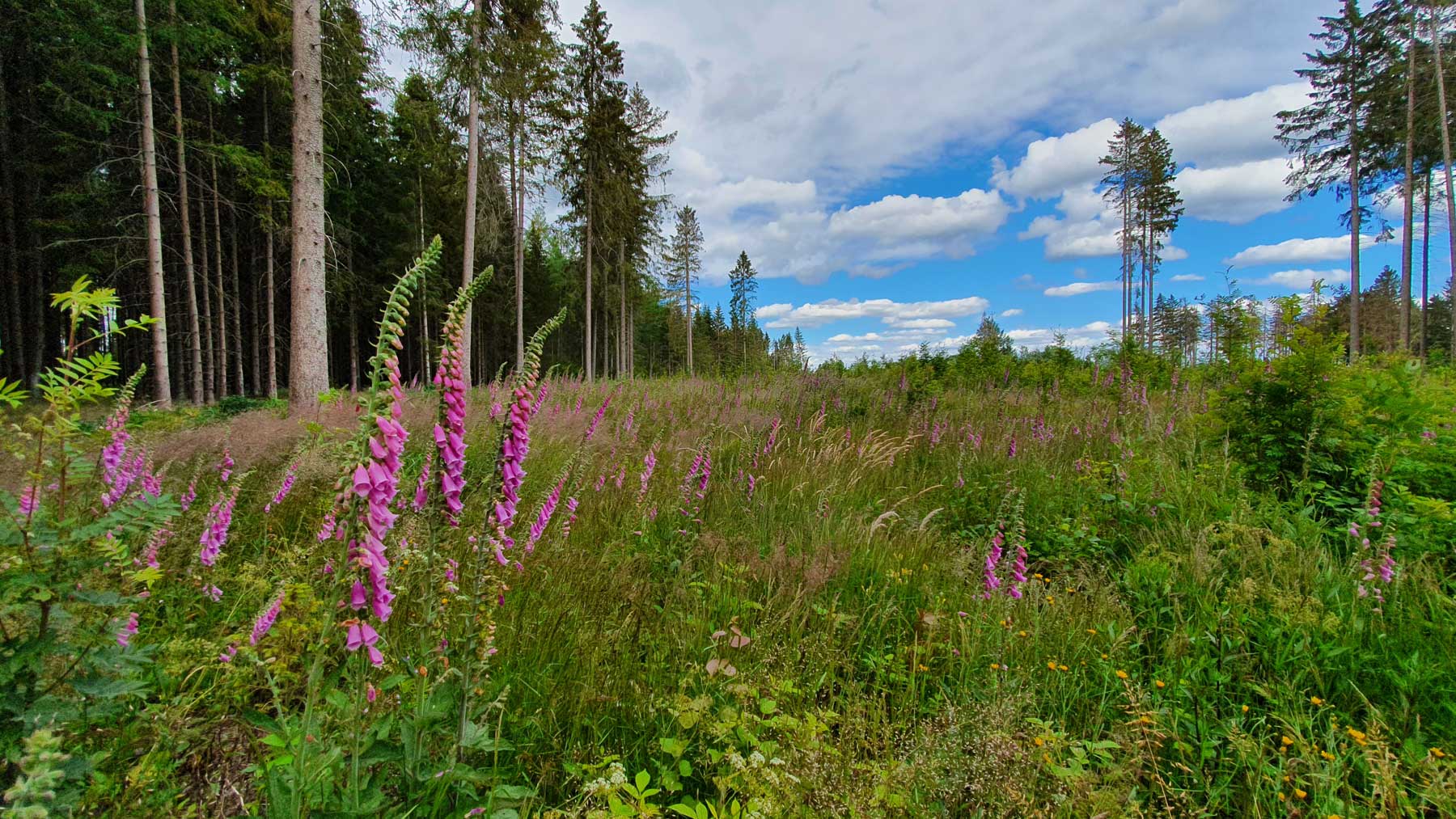
Where spruce trees once stood densely, small seas of thimbles, for example, have looked for their place in the sun. The forest change will take place visibly in the coming years. Until then, however, it is worthwhile to capture the beautiful views and finally to say that it is unique – here UP IN THE HARZ.


